


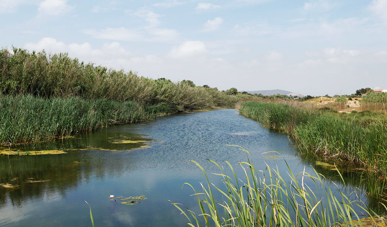
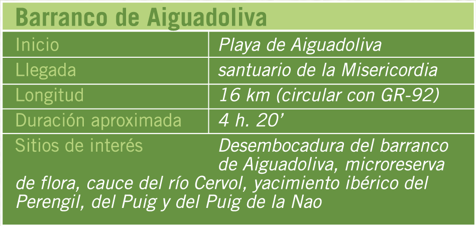
The trail begins at the mouth of Barranc d’Aiguadoliva ravine, located on Aiguadoliva beach, where visitors will find a post that indicates the direction to follow along the ravine bed. Later on you will cross highway N-340 via an underpass, and then the train line. A few metres ahead, you will see the field of Saint Gregory to the right, but you should keep going along the left side of the ravine bed. Soon after, you will go under the road to Càlig and further ahead to the motorway. To your left, you can see an interesting Iberian settlement called Puig de la Nao. Next, you will pass through the diversion of the Camí de Xivert hiking route, continuing on another path that goes on top of the ravine and moves away from it to cross fields of orange trees before later returning back to the path. You continue along the riverbed again for a long stretch and climb up the trail to the right which will bring you to the other trail on the left. Then, you follow until you arrive to the Càlig to UIldecona trail. Here, you will come across the micro flora reserve and its interpretation centre.
Afterwards, you will take the road in the direction of Ulldecona, passing through a gentle ravine until you see a dry stone shelter with another information panel. You will then cross highway N-340 and pass by several fields of orange trees until you reach Canet Lo Roig path to Vinaròs, where you should turn to the right. You should follow the Cervol riverbed until you have passed the motorway. Next, turn on to an ascending Trail among orchards and pine forest. This Trail will lead you to the Santuari de la Misericòrdia where this route ends. You can return to Vinaròs by the following GR-92 trail.